C-Astral Fixed Wing Systems.
Complete Product Line Sales
C-Astral Unmanned Aircraft Systems (UAS) are electronically powered and able to achieve superior stability and endurance through unique advanced Blended Wing Body airframe aerodynamics. Currently, C-Astral systems are flying with six sovereign entities on force protection, border protection, fire control and surveillance operations on four continents and more than 100 commercial and scientific operators globally.
C-Astral Unmanned Aircraft Systems can operate in extreme environments such as high altitude open-pit mines, deserts, mountains, Antarctica, over the Arctic and global agricultural lands.
Shop Fixed Wing Systems By C-Astral
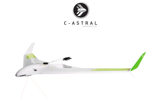
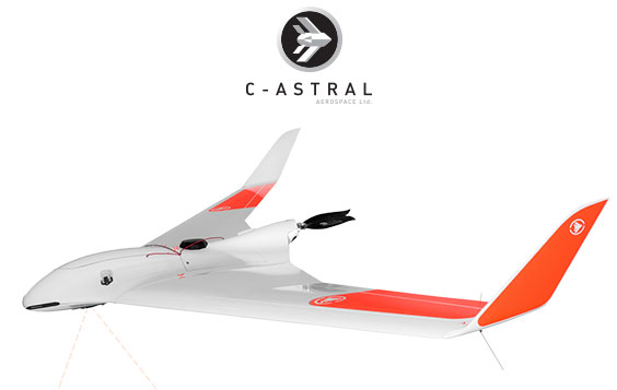
C-Astral Bramor mSX
Redefining Precision Remote Sensing
Learn More
Feature List Item
FEATURES: Thermal, multispectral and high resolution imagery in one sensor. Large area multispectral mapping. Dataling range up to 30km. Map over 500 ha at 150m AGL. Map over 2000 ha at 600m AGL
Applications
APPLICATIONS: Crop heath mapping, Phenotype, Water stress analysis, Scouting for leaks, Fertilizer management, Zone mapping, Bark beetle detection, Disease identification.
(1-800-UAS-1353)
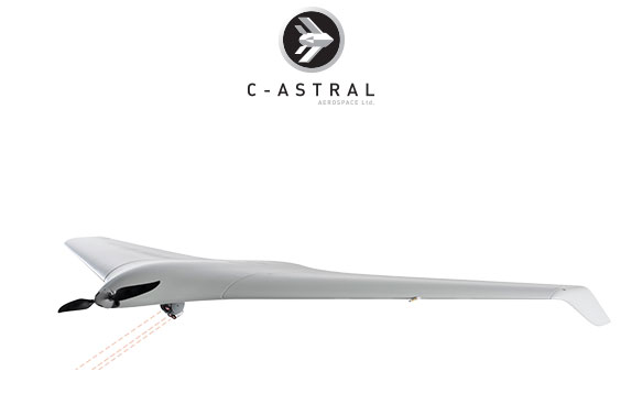
C-Astral Atlas C4EYE
Special OPS Surveillance System
Learn More
Feature List Item
FEATURES: Quiet operation at 80 m AGL. Flight-ready in less than 3 min. Modular Payload. Precise parachute landing 20x20 m. One Operator. 15 kg MIL std backpack.
Applications
APPLICATIONS: First responder operations, Search and rescue, Infrastructure control, Special operations, Civil defense, Fire control, Over the hill observation, Night surveillance, Classical ISR, Convoy following, Moving target detection and tracking, Low intensity conflict zone control.
(1-800-UAS-1353)
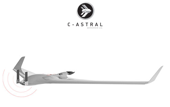
C-Astral Bramor sAR
Search & Rescue UAS
Learn More
Feature List Item
FEATURES: Search path 2km or wider. Low profile antennas. Location without DF equipment. Send and Receive Texts. Software defined radio. Gives Lat Long, displayed on embedded mapping. Can act as a mobile and Ad Hoc relay station. Designed to meet the extreme conditions of SAR operations. UI - simple to use. Any phone capable of GSM can be used. Radio Software Defined and Upgradeable. Web browser user interface.
Applications
APPLICATIONS: First responder operations, Search and rescue, Infrastructure control, Special operations, Civil defense, Fire control, Over the hill observation, Night surveillance, Classical ISR, Convoy following, Moving target detection and tracking, Low intensity conflict zone control.
(1-800-UAS-1353)
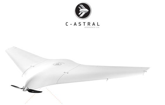
C-Astral Atlas ppX
Advanced Technology Light Acquisition System
Learn More
Feature List Item
FEATURES: Quiet operation at 80 m AGL. Flight ready in less than 3 min. Modular Payload. Precise parachute landing 20x20 m. One Operator. 15 kg MIL std backpack. Water resistant.
Applications
APPLICATIONS: Remote sensing, Precision agriculture, Environmental monitoring, Satellite data validation, Insurance, Critical infrastructure mapping, Construction, Mining.
(1-800-UAS-1353)

C-Astral Bramor C4EYE
Battlefield & Special OPS Proven
Learn More
Feature List Item
FEATURES: Up to 3h endurance*. Flight range up to 150 km. Video/Datalink range up to 40 km. No radar signature. 100% autonomous. Wind resistant up to 30 knots. In-flight waypoint management. Camera, Altitude, and Target prosecution guidance modes. Carbon / KevlarTM / VectranTM Construction. Simple flight planning. One or Two person operation. Catapult takeoff. Accurate Parachute Landing in a 30m x 30m zone. Convoy following capability. Robust fail-safe system for maximum safety. Flight ready in less than 5 min. Ability to track, Geo-register or Lock targets. AN/PVS-7B/D, AN/PVS-14 and AN/AVS-9 compatible IR optional beacons.
Applications
APPLICATIONS: Wildfire management, Search and rescue, Infrastructure control, Pipeline monitoring, Woods and landscape management, Flood monitoring, Civil defense, Fire control, Over the hill observation, Night surveillance, Classical ISR, Convoy following, Moving target detection and tracking, Low intensity conflict zone control, Battlefield management, Anti Poaching, Wildlife monitoring.
(1-800-UAS-1353)
C-Astral Bramor ppX
Survey Grade UAS
Learn More
Feature List Item
FEATURES: Best accuracy on the market (down to 0.6 cm). Post Processing Kinematic. Onboard survey grade L1&L2 (L5 ready) GNSS receiver. GPS, Glonass, Beidou, Galileo ready. Fast initialization. RTK datalink independent. GSD sub cm @ 70 m AGL. Integrated Optional IMU. 100% Autonomous. Automatic parachute landing. Orography capable flight planning. GSD maintenance over slopes, hills and valleys. Multiple sensors options. Wind resistance 30 knots. Operational temp -25°C to +45°C. Known point base station. Unknown point base reference Station. Virtual Reference Station. Compatible with RINEX Base data.
Applications
APPLICATIONS: Surveying and remote sensing, Infrastructure control, Precision agriculture, Flood monitoring, Open pit mining, Ecological monitoring and sensing, IED change detection, Wildfire management, Civil defense.
(1-800-UAS-1353)
Speak To An Expert
NEED HELP DECIDING?
Find The Right Industrial Drone or Imaging Solution
Need help finding the right drone, kit or accessory? Our highly trained staff is here to help you find the right solution for your project. Let's discuss your specific requirements.