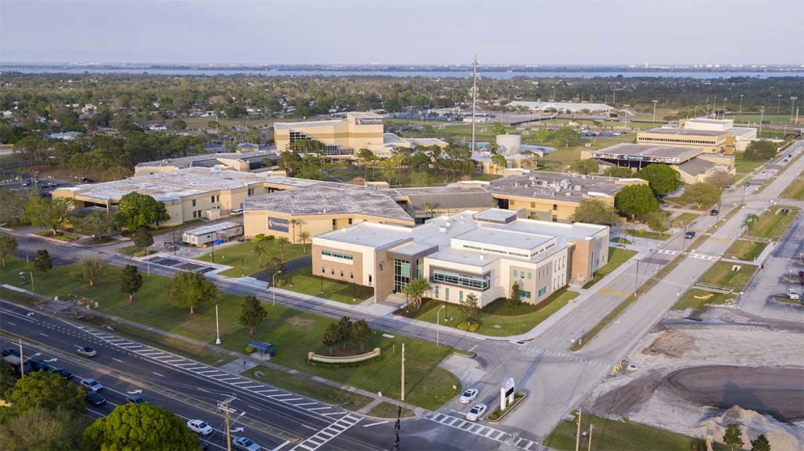
Our client, BRPH, is a multidisciplinary architecture, engineering, and construction services firm. With a focus on human-centered design, BRPH considers every aspect of the “lived experience” before they design & develop a structure. In recent years, BRPH has worked with Planet Inhouse to leverage drone technology to sharpen their services with advanced surveying, thermography, and aerial photography.
Business Objectives
Case Study
Enablement
Allow a wider breadth of services formerly cost prohibitive with traditional methods.
Efficiency
Significantly reduce risk and cost of surveying and thermography processes.
Quality
Vastly improve proposal quality with advanced datasets and assets unavailable before
The Challenge
Todd Reed, Graphics Manager and Principal at BRPH, is in charge of all forms of digital content acquisition. He knew that drone technology could bring significant benefits to multiple business units.

“We saw a technology rat race that would be hard to keep up with, so I thought it best to seek out expertise to help shorten our learning curve.”
Gather Insights
To ensure success, Planet’s team of general aviation and unmanned experts focused on delivering to the needs of three use cases central to many BRPH projects.
Key Steps
Case Study
Gather Insights
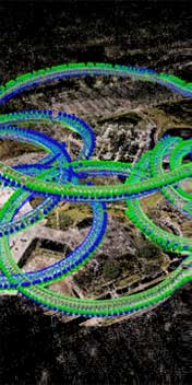
Aerial Surveying & Mapping
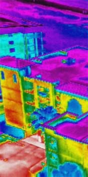
Aerial Thermography
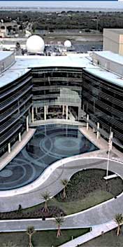
Aerial Photography
The core of the problem is collecting the right data in the right way from a site and making it accessible quickly to both business and technical stakeholders. This is rarely straightforward and requires considerable talent and tooling beyond drone hardware.
With the proliferation of drone technology, it’s trivial to add basic aerial capabilities to any team; however, a continued challenge is in selecting the right hardware and skillset combination for a specific use case. Further, once data is collected from a site, mastery of the appropriate software tools and methods to translate that data into useful formats for consumptions by multiple stakeholders remains an esoteric skill-set unavailable to many vendors.
Planet’s team utilizes an array of hardware and software to accommodate BRPH’s diverse needs across multiple projects. Additionally, many of the projects require advanced piloting skills which Planet’s team of certified general aviation and unmanned experts were ready to provide. Finally, it was important for BRPH to build expertise in house, so they invested in Planet’s recommended thermography certification courses and industry leading test and measurement tools.
Design an Ecosystem
Planet’s team of certified general aviation & FAA Part 107 sUAS pilots, along with infrared thermographers worked across multiple BRPH business units and supplied a combination of hardware, software and piloting to create 3D ortho-mosaic maps, infrared roof assessments and crack-shot aerial photography which improved existing services and helped win new business.
Key Steps
Case Study
Design an Ecosystem
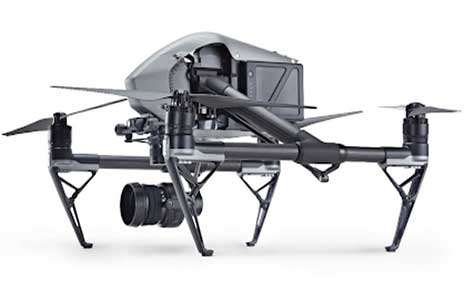

Inspire 2 Zenmuse x7


Matrice 210 Zenmuse XT2


Using drones to keep stakeholders aligned
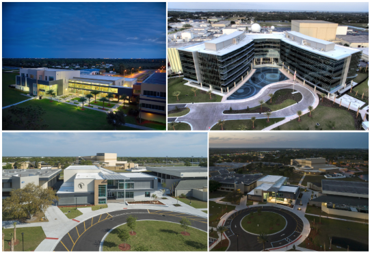
Some of the most visually stimulating work came from the collaboration to survey and map multiple Eastern Florida State College sites to create true-to-life renderings as part of surveying services or prior to breaking ground with projects. This proves to be a key step in providing the highest quality of service and maintaining stakeholder alignment throughout a project.
Key Steps
Case Study
Sureveying & Mapping

Creating a 3D ortho-mosaic map of Eastern Florida State College, Melbourne campus
Planet Inhouse uses the DJI Inspire 2 equipped with a DJI Zenmuse X7 camera to fly up to 200 acres in a single day, then PIX4D to reconstruct true-to-life 3D ortho-mosaic maps which BRPH teams use as the 3D environment in which to center building models. These visualizations make it easy for stakeholders to stay comfortable throughout the sales process and in-the-know before green lighting builds.
Click here to check out the Zenmuse camera line.


Inspre 2 Zenmuse X7


Time for surveying w/ hand operated total stations vs. drones
Using aerial thermography where traditional services are unsafe and costly
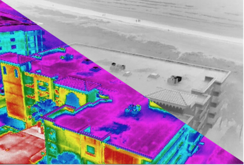
Several divisions of BRPH perform condition assessments on existing structures. Part of that service is an evaluation of flat roof surfaces to detect areas of moisture penetration, but traditional site walk methods are often dangerous, labor intensive and destructive to the property.
Key Steps
Case Study
Aerial Thermography
Flores Del Mar Ocean Condo infrared roof inspection
“Each year more than 310 construction workers are killed on rooftops and more than 10,350 are seriously injured by falls from heights.”
US Department of Labor
Planet Inhouse uses a DJI Matrice 210 drone equipped with the FLIR-powered XT2 thermal camera to satisfy an ongoing queue of aerial roof inspections. FLIR’s thermal reporting suite is used to quickly create actionable assets that both business and technical stakeholders can easily understand. This allows BRPH to offer these assessments with far less risk to life and property than traditional methods.
Contact us for an aerial thermography quote today


Matrice 210 Zenmuse XT2


Costs of traditional site walks w/ handheld thermal vs.drones
Getting the perfect shot for the next proposal.
BRPH continuously seeks to contextualize their work and creatively demonstrate their ideas. They rely on Planet’s expert pilots to capture those “worth a thousand words” shots as portfolio pieces for use in proposals and marketing assets. These shots are often key to winning new business.
Key Steps
Case Study
Advanced Aerial Photography
“Every request has been met with excellent service. I’ve had some pretty demanding shot requests that Planet Inhouse pulled off with no problem..”
Todd Reed, BRPH
Project Summary
Planet Inhouse, Inc. is always excited to work with BRPH as no project is ever the same. They are innovative and serve a wide variety of clients. BRPH uses the aerial technology to capture useful data that better serves their core clients. Whether it’s thermal scans, aerial mapping, surveys or marketing shots, BRPH sets the bar high when it comes to the products they deliver.
Todd Hillhouse
CEO, Planet Inhouse
About Planet Inhouse®
Planet Inhouse, Inc. provides support, sales, and services for unmanned applications. Our enterprise UAS platforms, including FLIR Aerial Infrared and C-Astral fixed wing systems, are among the leading sUAS available for a variety of commercial and government applications. We offer state-of-the-art technology both in the air and on the ground
Leading distributor of trusted hardware and software
Get support, sale, and service for enterprise UAS platforms including DJI, C-ASTRAL, as well as FLIR thermal reporting and PIX4D software packages.
Aerial and thermography services
Deliver on projects fast with on demand industrial surveying, 3D ortho-mosaic mapping, aerial thermography inspections, and professional aerial photography.
Certification and training services
Enhance internal capabilities with the right skill-sets, including IR certifications, software training and field support.

